天空中的于韋斯屈萊
Jyväskylä in the Sky
來源:Harri Kiiskinen|發表日期:2024-01-25
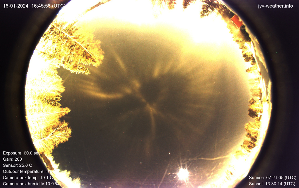
你可能無法一眼認出這張地球上芬蘭于韋斯屈萊市一個社群的街道地圖。但這可能是因為這幅地圖是在 1 月 16 日投射到夜空中,並由全天空照相機拍攝的。那個北方冬夜的氣溫約為零下 20 攝氏度。當冰晶在頭頂的大氣層中形成時,路燈的光照灑向頭頂的天空,產生了可見的光柱,其空靈的外觀是由於飄動的冰晶平面產生的鏡面反射造成的。當然,投射出的光柱描繪出了當地燈火通明的街道地圖,不過在攝像機的仰視視角中,光柱從右向左倒轉。人們看到,這幅光柱街道地圖在於韋斯屈萊的夜色中盤旋了數小時。
原文:You might not immediately recognize this street map of a neighborhood in Jyväskylä, Finland, planet Earth. But that's probably because the map was projected into the night sky and captured with an allsky camera on January 16. The temperature recorded on that northern winter night was around minus 20 degrees Celsius. As ice crystals formed in the atmosphere overhead, street lights spilling illumination into the sky above produced visible light pillars, their ethereal appearance due to specular reflections from the fluttering crystals' flat surfaces. Of course, the projected light pillars trace a map of the brightly lit local streets, though reversed right to left in the upward looking camera's view. This light pillar street map was seen to hover for hours in the Jyväskylä night.
※ 本文由萌芽機器人自動轉貼自每日一天文圖(Astronomy Picture of the Day,APOD),原文為英文,正體中文是透過 DeepL 翻譯及 OpenCC 進行自動處理,內容僅供參考,若有任何錯誤之處還請見諒!
關於每日一天文圖:每日一天文圖網站是美國國家航空暨太空總署與密西根理工大學提供的服務,網站每天提供一張影像或圖片,並由天文學家撰寫扼要說明其特別之處。